
Governor’s Mansion | South Carolina Public Radio
Audio
"G" is for the Governor’s Mansion [established in 1869]
Audio
"G" is for the Governor’s Mansion [established in 1869]
Video
Learn an overview history of the The Old Exchange & Provost Dungeon.

Audio
"S" is for Sayre, Christopher Gadsden. [1876-1935] Architect.
Audio
"M" is for the McBee Chapel in Conastee. [Constructed 1841]
Audio
"H" is for the Heyward-Washington House in Charleston [Built in 1772].
Audio
"G" is for Grand Strand. South Carolina’s Grand Strand is an uninterrupted strip of sandy beaches that officially stretches along sixty miles of Horry and Georgetown Counties from the North Carolina...

Audio
"M" is for McEntire Air National Guard Station. [1943-present]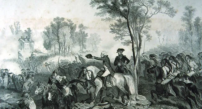
Audio
“E” is for Eutaw Springs, Battle of [September 8 1781]. The Battle of Eutaw Springs was the last major engagement in South Carolina during the Revolutionary War. In the bloody encounter, some two...