
Photo
The lock house on the Santee Canal, painted by Charles Fraser around 1820. South Carolina has an extensive river system whose major navigable rivers served as important transportation networks for...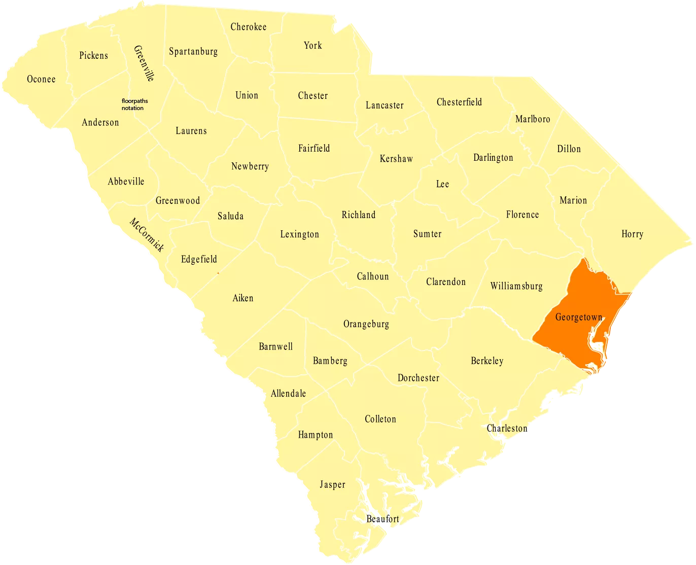
Although a number of Native American tribes already lived in the area and the Spanish had visited, English planters and their African slaves were the first to settle what is now known as Georgetown County. In 1769 Prince Frederick, All Saints, and Prince George parishes were combined, resulting in Georgetown District. In 1785 the district split into four counties including Winyah County. Winyah County would later be renamed Georgetown County in honor of King George II. Despite the approval of the British that this name suggests, Francis Marion regularly engaged in guerilla warfare from the county’s marshes during the Revolutionary War.
A coastal location has always served as a large source of wealth for Georgetown County. The location favored the growth of plantation crops, especially cotton and Indigo. In fact, Indigo planters became so affluent that they became their own level of high society known formally as the “Winyah Indigo Society.” Later, rice took over and became the crop of choice for Georgetown County plantation owners, but Indigo plants still grow wild in the area. Furthermore, the Georgetown Port, in the county seat of Georgetown, became such a source of income that pirates plagued the county’s coast.
Today one can easily observe a connection between Georgetown County’s past and its future. The African slaves brought over by British planters to farm cotton, Indigo, and rice have preserved the Gullah culture throughout the generations. This culture is especially evident on Sandy Island. Georgetown’s port still anchors the county’s economy. The county’s historical significance, coastal location, beach towns, and nature preserves make it a popular tourism destination.
Georgetown County, A Brief History. Accessed June 03, 2016.
http://www.georgetowncountysc.org/about/history.html

Photo
The lock house on the Santee Canal, painted by Charles Fraser around 1820. South Carolina has an extensive river system whose major navigable rivers served as important transportation networks for...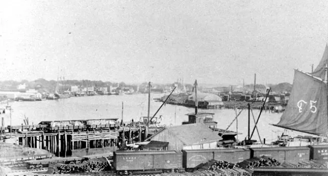
Photo
An industrial and commercial complex made up of lumber yards and shipping, operated by the Georgetown and Western Railroad and the Gardner and Lacey Lumber Company, characterized the Sampit River...
Photo
The paper industry in South Carolina is a major user of forest products of the state. This is the International Paper Mill in Georgetown, photographed in 1935. Courtesy of the South Caroliniana...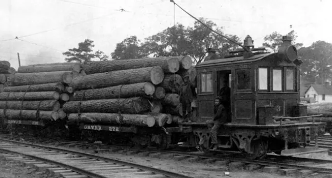
Photo
The Atlantic Coast Lumber Company in Georgetown generated its own electricity at the turn of the century, and used electric trolleys to move the logs and lumber around its large plant on the Sampit...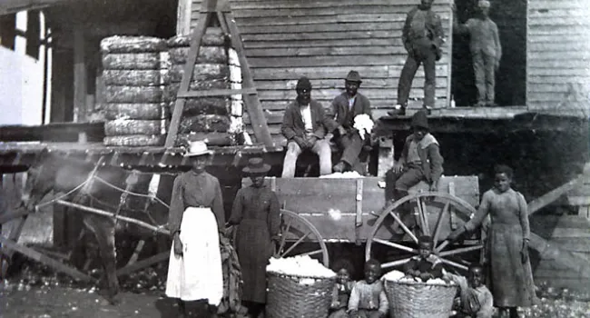
Photo
A cotton gin in operation at Strawberry Hill plantation, photographed in 1897. Courtesy of the Winthrop University Archives.
Audio
"G" is for Grand Strand. South Carolina’s Grand Strand is an uninterrupted strip of sandy beaches that officially stretches along sixty miles of Horry and Georgetown Counties from the North Carolina...
Audio
“B” is for Black River. The Black River takes its name from its tea-colored waters. The river begins in the Sandhills of Lee County, and is joined at Rocky Bluff Swamp near Sumter. The Pocotaligo...
Photo
This Queen Anne style house was built in Georgetown at the east corner of Front Street and James Street by Dr. H.A. Farris, a dentist. Its four octagonal rooms on each floor all had five windows and a...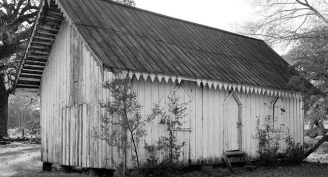
Photo
The board and batten siding on this slave cabin on the Arundel Plantation in Georgetown County was promoted as an efficient form of house construction from 1850 onward, and is widely seen in...