Welcome to Catawba River!

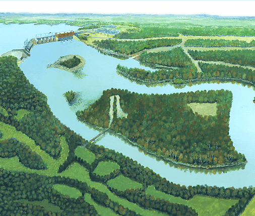
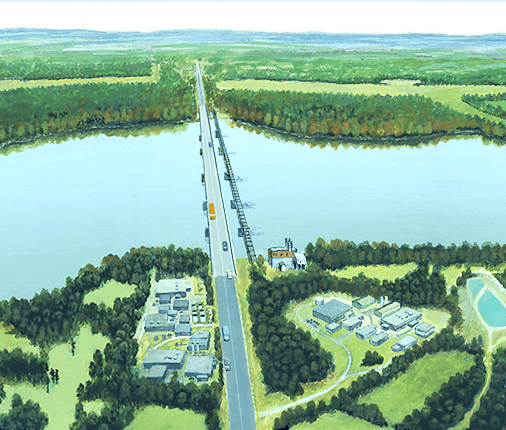
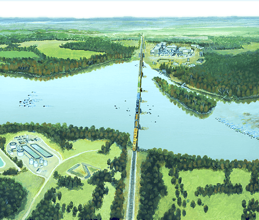
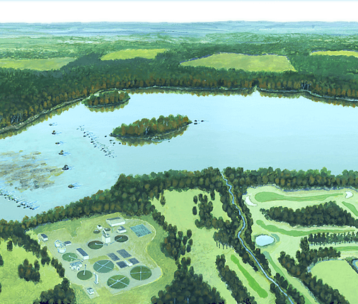
From the Appalachian Mountains, the Catawba River flows south through the Carolina Piedmont, where it becomes the Wateree River and eventually flows out to the Atlantic Ocean as the Santee River. From the earliest Native Americans to present day kayakers, people have always been drawn to the power of the Catawba River. On your Catawba RiverVenture you will explore several areas of the river that tell the stories of how the Catawba River has shaped the land and our history, and how we are still connected to the river today.

The landscape is full of objects that will help you answer these questions. Scroll over the landscape to find objects and click on them to learn more. Some objects are easy to find, but some are hidden. Every object you find has a clue for your notebook. When you have collected all the clues, file a River Wrap!

Begin

Catawba Nuclear Station

You might not think of the river as playing a part in nuclear power. However, nuclear power generation uses water in at least two phases of its electricity generating process. Duke Energy’s Catawba Nuclear Station on Lake Wylie began operating in 1985 and can generate up to 2,258 megawatts of electricity. South Carolina gets more than half of its electricity from nuclear power; in the entire United States, about 20 percent of our electricity is generated from nuclear power.

How is nuclear power harnessed to make electricity? In the reactor, Uranium 235 atoms are split, releasing an incredible amount of heat. This energy is used to heat water and generate steam that turns a turbine. The turbine turns a magnet inside the generator which is what produces electricity.

Water, from the lake, is also used to cool and condense the steam back into water to be used again in electrical generation. This cooling process also generates steam, but the steam from the cooling process is released in to the atmosphere. You can see the clouds of steam from the Catawba Nuclear Station cooling towers from miles away.

Close

Duke Energy Archives

Catawba Nuclear Station under construction

Duke Energy Archives

Catawba Nuclear Station cooling towers under construction

Clue:

Water from the lake is not needed to make fission happen – it is used to make steam from the heat released by the process.

Add clue to notebook

Duke Energy website

How do nuclear stations work?

Google Earth

Catawba Nuclear Station

Next
Prev

A River Runs Through Your Home

In your home you use water every day, for brushing your teeth, washing dishes and clothes and more. Where does that water come from? For most of us, our water comes from a river. Even if your water comes from a well, the groundwater from the well is connected to a river. When you are “finished” with the water, where does it go? Down the drain, certainly, but after that it gets carried away from your home through pipes. If you are connected to a sewer system, the water and waste get carried to a waste water treatment facility where the water is treated before it is returned to the river. If you are on a septic system, the waste that leaves your house goes to a tank that is periodically pumped to remove solid wastes. Both of these protect local water supplies from being contaminated with our waster.

You use water outside your home as well when watering the garden or washing your car, for example. In cities and many neighborhoods, that water goes down a storm drain. Storm drains dump directly to a river, the water isn’t treated to remove chemicals or other pollutants. That means if you dump oil, paint, or even too many grass clippings down the storm drain, it isn’t healthy for the river.

Nonpoint source (NPS) pollution is pollution that comes from many diffuse sources. As rain or snowmelt move across the ground it picks up and carries away pollutants. Pollutants are things like chemicals from fertilizer or soap from washing your car--even too much soil in the water is a pollutant. Since water moves downhill to the lowest point, these pollutants are carried to lakes, streams and rivers. A single river or stream can be a collection point for pollutants from many different places in the watershed.

When land is developed for new homes and developments, vegetation is often the first thing that is removed from the building site to clear a place for the new buildings. Once the vegetation is gone, there is nothing to hold soil in place when water from rain or snow moves across the land. Soil particles, also called sediment are carried to creeks and streams and ultimately to the river. Sediment carried by stormwater runoff is the largest source of pollution in many rivers.

Close

CHM

There’s a river in your faucet

Clemson Extension 4-H

Water from storm drains isn’t treated before entering waterways

Clue:

Through recreational activities, like fishing, boating, sailing, people use the water every day. To protect the waters from pollution, there are laws for boaters to follow including disposal of oil waste and storage bins for trash.

Add clue to notebook

Catawba RiverKeeper

Sedimentation from Sugar Creek in the Catawba River

Next
Prev

Hill's Ironworks

William Hill (1741-1816) was a blacksmith and ironmaster who lived on Allison Creek, a tributary of the Catawba River in what is now York County, South Carolina. Hill began his iron manufacturing career in the early 1770s with a basic blacksmith’s forge where he produced wrought iron tools and utensils. After the War for Independence began, Hill actively supported the Revolution and produced cast iron products, including cannons and cannon balls for the South Carolina government. Hill’s Ironworks also produced a wide variety of household and agricultural goods, including ploughshares, anvils, hammers, kettles, Dutch ovens, stoves, and wagon and cart boxes. Almost 100 African-American slaves worked in the operation of the furnace and related activities. Some of these other activities like sawing lumber and grinding grain relied on water power from Allison Creek. Slaves also mined the ore that came from Nanny’s Mountain, not far from the Ironworks.

In early June 1780, Hill’s ironworks became a campground for the local Whig militia. As a result of this activity, on June 17, 1780 Hill’s Ironworks was attacked and completely destroyed by British soldiers. Hill served as an officer under General Thomas Sumter for the duration of the Revolutionary War. Following the end of the war he rebuilt his ironworks and added a second blast furnace. Hill’s Ironworks continued in operation until sometime after 1810, but it was not very profitable. By the time of Hill’s death in 1816 the ironworks had closed.

One of the chief difficulties faced by the early iron industry in the upcountry was the lack of good roads and navigable rivers for transporting heavy loads. After Hill’s Ironworks closed, iron manufacturing in York County moved from Allison Creek to Kings Creek on the Broad River, where it flourished until after the end of the Civil War. In 1925 the site where Hill’s Ironworks stood was inundated when the height of the dam at India Hook shoals was increased.

Close

Robert Mills’ Atlas of South Carolina, 1825

“Hill’s Old Iron Works” circa 1820

CHM

18th century cannonballs made at Hill’s Ironworks

Clue:

Water power was used to operate the bellows in the blast furnaces. Bellows blow air into a fire, causing it to burn hot enough to melt the iron so it can be poured into molds.

Add clue to notebook

CHM

1813 plat of Hill’s property; note the sawmill, ironworks and grist mill

Next
Prev

Damming the River

Hydroelectricity harnesses the power of the river to generate electricity. In 1899 a South Carolina civil engineer named William Church Whitner came up with the idea to build a dam and a hydroelectric power station on the Catawba River at India Hook Shoals above Rock Hill. Whitner obtained financial backing from two Chester County physicians, Dr. Walker Gill Wylie and his brother Dr. Robert H. Wylie. Together they formed the Catawba Power Company, the first of several utility companies that would use the power of the river to generate electricity. In 1900 the Catawba Power Company began construction of a twenty-foot high dam at India Hook Shoals. In 1901, Gill Wylie enlisted one of his patients, wealthy tobacco magnate James Buchanan Duke, to help finance the dam’s completion. The Catawba Hydroelectric Station began generating electricity on April 30, 1904, and its first customer was Rock Hill’s Globe Cotton Mill. Over the course of the following year almost every other textile mill in York County made the conversion from coal-fired steam power to electrical power from the river. This conversion guaranteed a large customer base for Catawba Power and allowed it to expand into municipal and residential power distribution.

In 1905 Wylie and Duke formed the Southern Power Company to build additional dams on the Catawba River and further electrify the Carolina Piedmont. From 1924 to 1925, the Southern Power Company replaced the original twenty-foot dam with a new powerful structure that was over four times the height of the original. The lake it created had a total surface area of 13,400 acres and boasted 325 miles of shoreline. In 1927, the Southern Power Company was reorganized as the Duke Power Company, and went on to become the pre-eminent electrical power utility in the area.

The dam and power station at India Hook Shoals were the first of eleven such facilities constructed on the Catawba River over the next twenty years. By the end of the 1920s, the Catawba River valley had become the most heavily electrified water system in the Southeast, a distinction that it still holds today. In October 1960, Duke Power changed the names of the original Catawba Lake and Power Station to Lake Wylie and the Wylie Hydroelectric Station in honor of their founder. The construction of nuclear power stations on the Catawba and Broad Rivers in the 1970s and the 1980s relegated the old hydroelectric plants to secondary status for power production. However, the dams still play a vital role in regulating the flow of the river and maintaining the lakes that are now such an important part of the area’s economy and livelihood.

Close

CHM

Dam Site #1 in surveyor’s log for Catawba Power Company

Millard Stafford

Original dam and hydrostation at India Hook Shoals circa 1910

Duke Energy Archives

Catawba Power Company announcement

Clue:

The Wylie Hydroelectric Station currently is used only to generate additional power during times of high demand, like the summer season.

Add clue to notebook

Duke Energy Archives

Dr. Gil Wylie

Millard Stafford

Southern Power Company rebuilding India Hook dam circa 1924

Duke Energy Archives

Rebuilding the India Hook dam, 1925

Duke Energy website

How is hydroelectricity generated?

Next
Prev

Ferrying on the Catawba

Prior to the construction of road bridges in the early twentieth century, the only way to cross a river was to either wade through the water at a ford, or to cross it by means of a ferry. A ferry was a flat-bottomed boat that was used to transport people, animals, wagons, and eventually, automobiles across rivers. Early ferries were moved across the rivers by means of long poles, which the ferry operators used to push their boats. Later, horses and mules were used to pull ferries across the waters. In the twentieth century, gasoline engines and winches were used to pull the ferries back and forth on long steel cables.

Ferries came into use during the colonial period on the Catawba River and other upcountry rivers in the Carolinas. Ferry operators were allowed to charge a toll for their services. Local governments controlled the rates of ferry crossing to keep operators from exploiting their customers. Ferries were at their most numerous in the late nineteenth century, when there were dozens on the Catawba River alone. In the early twentieth century, the increase in the use of automobiles led to the construction of wooden and steel bridges across the rivers and the use of ferries declined. The last state operated ferry in South Carolina was located on the Catawba River between York County and Lancaster County. Known as Ashe’s Ferry, it was operated by members of the Catawba Indian tribe, and remained in use until 1959, when it was replaced by the Highway 5 Bridge.

Close

National Archives and Records Administration

Three of the many ferry crossings on the Catawba River

CHM

Ashe Ferry, 1930; the ferry was still operated by poling across the river

CHM

Ashe Ferry, 1959, not long before the ferry stopped operating

Clue:

Since the early 20th century, the increase in automobiles has led to the construction of bridges, making ferries obsolete.

Add clue to notebook
Next
Prev

State Scenic River Designation

Landowners help the river by leaving trees and other plants between their land and the water. This green ribbon of vegetation is called a riparian buffer.  Riparian buffers help protect water quality and aid in keeping the water temperature cool which helps aquatic organisms such as fish and clams survive.  Riparian buffers also provide travel corridors for large animals like deer.  The roots of trees and other plants help hold soil in place, preventing sedimentation.  These plants and trees also trap and help remove contaminants from the water and soil, which prevents pollution from entering the river.  Furthermore, riparian buffers help ensure the river remains scenic for all generations to enjoy.

On the Catawba River, there have been several efforts to conserve and protect water quality, plants and animals, cultural and archeological sites, and the aesthetic values of the river.  These efforts have resulted in a reach of the Catawba River from the Lake Wylie dam to Highway 9 being designated as a South Carolina State Scenic River.  Once a river has been designated as a state scenic river, the South Carolina Department of Natural Resources (SCDNR) forms an advisory council and works with local landowners along the river to determine the best way to manage the river.  One of the best tools to conserve and manage the Catawba River is the development of riparian buffers.

Close

CHM

Trees along the Catawba River provide a riparian buffer

CHM

Many animals use riparian buffers as habitat

Phil Weinbach, SCDNR

Map of the Scenic River section of the Catawba River

Clue:

Riparian buffers maintain biodiversity in an area. If one organism’s habitat is protected from sedimentation or pollution, the biodiversity of the entire ecosystem benefits.

Add clue to notebook
Next
Prev

Osprey

The osprey, or “fish hawk,” is a bird of prey that specializes in hunting fish. Ospreys are common along the Catawba River, where they fly 30 or more feet above the water scanning for fish. When a fish is spotted, the osprey folds it wings and plummets into the water, sometimes emerging with a prize catch in its talons. As the osprey flies to a perch or its nest, it clutches the fish with both feet and the fish’s head turned into the wind to cut down on air resistance.

Ospreys mate for life and use the same nest each year, adding more sticks and small branches to the nest each season. Snags are favorite nesting sites, but ospreys will occasionally build nests on human-built structures, such as power transmission towers

Close

U.S. Forest Service

Mark Catesby’s Osprey or “Fish hawk”

Dave Herr, USDA Forestry Service Photo Library

Osprey in flight hovering and hunting.

Clue:

Osprey have a special adaptation in order to grip slippery fish: on the bottom of its talons are tiny spikes that help catch fish.

Add clue to notebook

USFWS

Osprey on nest with mate

Next
Prev

Power Transmission

Electricity might be generated near the river, but we use it in our homes and businesses, often far from the power source. Power transmission lines like these transmit electricity over long distances. In fact, power transmission played a large part in James Buchanan Duke’s vision to “Electrify the Piedmont.” Duke’s vision involved creating a network of hydroelectric stations that would be linked together. These stations could provide power and electricity to a growing textile industry, but only if the power could be transmitted over long distances. On the 1905 Transmission map you can see where electricity is generated at each of the hydroelectric stations on the Catawba and other rivers. The circles indicate locations of hydro stations and the dark lines indicate the location of transmission lines. The map also shows where the textile mills using the electricity were located--each dot represents 10,000 “spindles” within textile mills. Many of the textile mills were located in other counties and even other states. The electricity the mills needed was carried over long distances over transmission lines.

Even today when you flip a switch or turn on a computer in your home, most likely the electricity has traveled some distance to get there. Electricity leaves the generating station at a level of 44,000 to 525,000 volts. The average outlet in your house delivers about 120 volts. Between the generating station and your home, substations and transformers convert electricity to a level that can safely be used by consumers.

Close

Duke Energy Archives

Linemen raising transmission pole with a gin

Duke Energy Archives

Linemen perched on a 100 kilovolt tower

Duke Energy Archives

1985 transmission tower

Clue:

Large power poles and transmission towers are favorite nesting places for large birds of prey, like the bald eagle and osprey.

Add clue to notebook

Duke Energy Archives

1905 Duke Energy Transmission map

Next
Prev

River Cane

River cane (Arundinaria gigantea) is a member of the grass family native to bottomlands associated with rivers in the southeastern and central United States. River cane can form dense thickets or canebrakes and serves as important habitat for a variety of birds and mammals.

River cane was historically important to Native Americans and is still used by the Catawba Indians today. The stems of river cane were used for blowguns and fishing spears, while the leaves were woven into mats and baskets. When European settlers arrived, canebrakes were abundant. The early Naturalist William Bartram wrote about canebrakes in the southeast that extended as far as the eye could see. Today only a fraction of canebrakes remain due to invasive species and habitat destruction caused by land development and agriculture. Catawba Indians still use river cane to make flutes, blow guns and baskets. Since these traditions rely on river cane, the decline in its populations is of great concern.

Close

Ted Bodner, Southern Weed Science Society

River cane growing in river floodplain

USDA Forestry Service

Workers planting and monitoring river cane

Clue:

As the moving water slows down in a canebrake, it can no longer carry sediments. Those sediments are deposited along the shore, filtering the water and keeping soil in place.

Add clue to notebook

Speck, 1946

Catawba blow gun made from river cane

Next
Prev

Fishing in the Catawba River

You might see people fishing in the river perched on rocks like these. For thousands of years people have been fishing in the Catawba River. Early Native Americans took advantage of the rocky formations in the Catawba River to build fish weirs. To construct a weir, stones were stacked in a river to form a “V” shape, with the wide opening facing upstream. As fish swam downstream into the rocky funnel, they were trapped in baskets placed at the narrow opening at the bottom of the “V”. Near the Nation Ford Road and Train Trestle on the Catawba River you can still see the double-V shape of the fish weir when the water is low. Years ago there would have been many more fish weirs, but many of these have been destroyed by development or covered over in dam-created lakes.

In addition to fish weirs and fish baskets, Catawba Indians also used spears, bow and arrow and poison to capture fish. To poison fish, the Catawba would add horse chestnuts or black walnut bark to a pool of water and stir the water. As the chemicals from the trees mixed with the water, the fish were temporarily stunned. The stunned fish floated to the surface of the water where they could easily be collected. While Catawba Indians no longer use poison, fishing remains an important connection to the river to this day.

In the past, there were more species of fish in the Catawba River than there are today. Sturgeon and shad were once so numerous that there were several commercial fisheries along the Catawba River north of the Great Falls. These fisheries probably took advantage of the seasonal runs of the migrating fish. However, the proliferation of grist mill dams and sedimentation from agricultural runoff led to a decline in fish populations in the early nineteenth century. When there were no longer enough fish in the river to sustain the business, the commercial fisheries closed. Ultimately, hydroelectric dams prevented any further migration of fish in the Catawba River. While sturgeon and shad still live in the Atlantic Ocean today, they are no longer found in the Catawba River.

Close

CHM

Fishing at the base of Lake Wylie Dam

CHM

Fish basket from CHM collection

Speck, 1946

Catawba fish arrow, spears, dugout canoe and bait gourd

Clue:

Commercial fisheries took advantage of fish migration and captured fish to breed and sell.

Add clue to notebook

CHM

Robert Mills’ Atlas of South Carolina, 1825

Next
Prev

Carolina Crossroads Experience

In 1998, Jane Spratt McColl donated 400 acres of riverfront property to the Culture & Heritage Museums (CHM). At this location north of the I-77 bridge, the CHM will build the “Carolina Crossroads Experience: Museum of Life on the Catawba River.” The Carolina Crossroads Experience will be a place where visitors can reconnect with nature and learn about the roles both river and land have played in our history. The very location of the Carolina Crossroads Experience lies near an important crossroads, the intersection of the Catawba River and the Nation Ford Road. Visitors to the new museum will explore the crossroads, have access to the river, find out what it means to live in a watershed and learn how we can take care of the natural world that has been and will continue to be a part of our story.

In addition to exhibits and outdoor experiences at the Carolina Crossroads Experience, the Carolina Thread Trail will be a feature of the Carolina Crossroads Experience. The Carolina Thread Trail creates a regional vision to link greenways and trails in 15 counties of North and South Carolina. The Carolina Thread Trail will develop over time and will eventually link parks, green spaces and attractions throughout the region.

Close

Google Earth

The modern day crossroads of the Catawba River and I-77

CHM

Reconnect with nature at the Carolina Crossroads Experience

Carolina Thread Trail

Concept map of the Carolina Thread Trail

Clue:

The Carolina Crossroads Experience will tell the stories of the Catawba River and how we are still connected to the river every day.

Add clue to notebook

CHM

View of the Catawba River from the location of the new museum

Next
Prev

Invasive Plants and Animals

Probably the most well-known invasive species to the southeastern United States is kudzu, a fast-growing climbing vine that can overrun native plants and habitats. Because kudzu prefers open areas, river corridors and forest edges are prime habitat for this invasive vine. Although kudzu is native to Asia, it was intentionally introduced to the southeast decades ago to control soil erosion.

Numerous non-native species of plants and animals have been accidently and intentionally introduced to the southeastern United States. Because these newcomers have few natural predators and the ability to out-compete native species, they can quickly take over habitats.

The Northern snakehead fish (Channa argus) is native to China and Russia and may have been introduced to regional waters through Asian fish markets, where fish are often kept alive until purchased for food. They are also sometimes kept as an aquarium fish. Snakeheads thrive in oxygen-poor water and feed on large quantities of native fish.

The Asian clam (Corbicula fluminea) is another invasive, non-native species. Like the snakehead fish, Asian clams can be purchased live in fish markets. They are also used as bait, where unused clams are often dumped into rivers. This species out-competes native mussels wherever it is found.

Close

SCDNR

Northern Snakehead an invasive fish native to Asia

Noel M. Burhead

Asian clam an invasive freshwater mollusk

Jan Carroll, U.S. Fish and Wildlife Service

Close-up view of kudzu thicket

Clue:

When an invasive species, like the Northern Snakehead fish, is introduced into an ecosystem, often it has no natural predator in the energy pyramid. The invasive population can increase and overrun native species.

Add clue to notebook

Jan Carroll, U.S. Fish and Wildlife Service

Forest overgrown by kudzu

Next
Prev

Crossing the Catawba River

Before bridges spanned the Catawba River, crossing the river was a challenging proposition. In the past, people crossed the river in shallow areas called fords, or rode across the river on ferries. While bridges spanning streams or smaller rivers may have been common place in the late 18th century, the large bridges across the Catawba River weren’t built until the late 19th century. Most likely, this coincided with the rise in automobile use.

One of the earliest bridges to cross the Catawba River along this stretch was a bridge just downstream from Greater Carrother’s Island. In an 1897 request to have a bridge connect Fort Mill and Yorkville (now York), one citizen of Fort Mill explained “…the inconvenience of getting across the river. In times of high water it was impossible, except on foot over a narrow plank, on the railroad bridge, and in times of ordinary low water, on account of the fact that there is only one wire ferry on the river for miles, and none of the other ferries are reliable, to get across it is often necessary to travel many miles out of the way.”

Bridges were occasionally built at former ferry crossings or fording spots. The roads leading to the river crossings at these points were already in place, making it a convenient, familiar place to build bridges. For example the modern Highway 5 Bridge was built at the site of the old Ashe’s Ferry in 1959.

Close

CHM

1910 map showing bridge across the Catawba River

CHM

View of the I-77 Interstate bridge from the river

CHM

Highway 21 bridge also carries water to Fort Mill

Clue:

In the 1800s, bridges had many advantages over ferries. They provided a direct route that was not affected by the rise or fall of the river water level.

Add clue to notebook
Next
Prev

1756 Catawba Indian Villages

The Catawba towns on the banks of the Catawba River played an important role in international politics during the colonial period.  In the 1750’s, the North American colonies east of the Appalachian Mountains were still a part of the British Empire. The Nation of France had extensive territory on the western side of the Appalachian Mountains and wished to extend its influence to the Atlantic Ocean.  The conflict between these two world powers is known in Britain as the Seven Years War, but most Americans know it better as the French and Indian War. Both European nations enlisted the help of the Native Americans as military allies and to protect areas of strategic importance. Native Americans in the Carolinas were divided in their support of the European powers. The Cherokee Nation was allied with France and the Catawba Nation was allied with Britain.

One place of strategic importance that the British wanted to protect was the Nation Ford Road, especially where it crossed the Catawba River.  The Nation Ford Road was a part of the Great Wagon Road that linked South Carolina with Virginia and Pennsylvania.  Keeping the road open for trade and communication was very important to the British.  In 1756 a Scottish trader named John Evans drew a map of several Catawba Villages that were located near the crossroads of the Nation Ford and the Catawba River (then called the Wateree River).  On the map, Evans noted that there were “men fit for warr 204 In ye year 1756” (204 men fit for war in 1756) along with the names of the towns.  Evans was recording this information for British leaders so they would know how many Catawba warriors they could count on to defend the Nation Ford.

These Catawba towns were established for the purpose of defending the Nation Ford and were pallisaded fortresses. The Catawba who were living there were heavily armed, courtesy of the British Empire.  In fact, the Catawba were so busy defending the British territory that they didn’t have the time to hunt and collect food for themselves.  In response to this, the British drove a herd of cattle down from Salisbury, NC, to provision the Catawba.  The British knew that controlling the Nation Ford would give them a strategic advantage over the French.

The Catawba continued to fight alongside the British throughout the French and Indian War until 1759.  When many Catawba warriors returned home, they brought with them a dangerous and virulent virus--small pox.  Unlike the European settlers, Native Americans had no natural immunity to the virus.  As a result, the small pox virus killed a great number of Catawba people.  The remaining Catawba fled the site of these six towns and relocated near what is now Camden, South Carolina.  Eventually, the Catawba returned to the York County region and the Catawba Nation today is located on the banks of the Catawba River south of Rock Hill.

Close

Library of Congress

Deerskin map illustrating the Catawba towns (circa 1720)

SCOTLANDIMAGES.COM

1756 map of Catawba Villages and census of Catawba warriors

CHM

Bead from archaeological excavations at site of Weyapee and Nassaw

CHM

Pottery from archaeological excavations at Weyapee and Nassaw

Clue:

The current site of the Catawba Nation lands is downstream from Nation Ford, on the west bank of the river.

Add clue to notebook
Next
Prev

Water Supply

The brick structure located on “Pump Station Road” is just that, an old pump station for the City of Rock Hill water supply. While this pump station is no longer in use, the City of Rock Hill and many other municipalities still draw their water from the Catawba River. Today, the City of Rock Hill draws its water from the Catawba River but uses a withdrawal point in Lake Wylie, which provides a much more stable and reliable water source than drawing directly from the river.

Water is pumped from Lake Wylie to the Rock Hill filtration facility. In the filtration facility, water is tested, cleaned and treated before it is distributed to customers in Rock Hill, Fort Mill, the Catawba Indian Nation and other portions of York County. There are many quality control standards in place and the City performs rigorous testing to insure that water quality standards are maintained or exceeded.

Close

CHM

Rock Hill’s former pump station

City of Rock Hill

Clear well at Rock Hill filtration facility

City of Rock Hil

Settlers used in part of the filtration process

Clue:

Municipal, or city, governments provide many services for citizens including maintaining the quality of drinking water. Waste water is also treated to keep residents and the environment healthy.

Add clue to notebook

City of Rock Hill

Water towers maintain water pressure through water delivery system

Next
Prev

Aquatic Macroinvertebrates

Most of the animals that live in streams and rivers are quite small. Some cannot be seen without a microscope, but others are large enough (macro-sized) to be seen with the naked eye. These small invertebrates include worms, clams, insects and their relatives. Many macroinvertebrates spend part or all of their life cycle in water. Clams and mussels are completely aquatic, while insects such as dragonflies and caddisflies only spend the first part of their lives in water.

Many of these aquatic macroinvertebrates can only survive in clean water that has lots of oxygen. For that reason, the presence of these small creatures usually means the water has little pollution or sedimentation. When scientists and researchers want to know more about the quality of water in a river or a stream, they use macroinvertebrates as water quality indicators. If there are a high number and diversity of aquatic macroinvertebrates in a water sample, that usually indicates good water quality.

Close

Chris Humphrey

Sample of macroinvertebrates

Mark Catesby’s Natural history of America. 1997. Merrell Holberton Publisher’s Ltd.

Drawing by Mark Catesby of aquatic insects showing larval and adult stages

Clue:

Water samples that score a biotic value above 60 are considered good, but a score under 40 is considered poor water quality.

Add clue to notebook

Bill Stokes

Damselflies lay their eggs in clean water

Next
Prev

Industry and the River

This unique building was the river pump house for the Celanese manufacturing facility in Rock Hill. The Celanese Company is well-known for manufacturing cellulose acetate and other fire retardant polymers that were used in the textile industry. The Rock Hill manufacturing facility was also a bulk producer of methanol and formaldehyde. The Celanese facility was so extensive it had its own pump house which was used to withdraw water from the Catawba River. Water was filtered on site and used primarily as cooling water in manufacturing processes. Approximately 40 million gallons of water per day were used in cooling processes alone. Celanese also had a waste water treatment plant where up to 8 million gallons of water per day were treated before being returned to the Catawba River. At the height of operations, the plant had 2,200 employees working on site.

The Celanese facility is an example of another way that many industries use rivers--to carry away waste from industrial processes. Before 1970 the effluent industries discharged into our rivers was largely unregulated. In the 1970s the Clean Water Act was passed to “establish the basic structure for regulating discharges of pollutants into the waters of the United States” (www.epa.gov). Now, industries must treat their effluent to remove contaminants before that water can be returned to the river.

Close

CHM

Celanese pump station, 2009

CHM

Inside the pump station, 2009

Celanese Corporation; (http://www.hugovandermolen.nl/)

Celanese stock certificate

Clue:

Celanese is actually a brand name which has been used for over 80 years. It combines the words “cellulose” and “ease”.

Add clue to notebook

Celanese Corporation

Vew of Celanese when it was still in operation, circa 1985

Next
Prev

Modern Day Industry and Rivers

While Celanese is no longer operating on the Catawba River, there are other industries that currently rely on the Catawba River. Approximately 68% of the non-power generating water in the Catawba River is used for industrial processes in South Carolina. Water supply for residential use accounts for only 30% of non-power generating water use.

Effluent from factories is still regulated by the Clean Water Act through the National Pollutant Discharge Elimination System (NPDES). The NPDES permit program controls water pollution by regulating point sources--factories, businesses, industries--that release pollutants into fresh water like rivers and streams. Industries that discharge directly into a river or stream must have an NPDES permit.

By monitoring what is put into our rivers, the Clean Water Act (CWA) has improved the quality of our rivers. However, rivers now face a different kind of pollution threat. Non-point source pollution threatens water quality in many of our rivers. The Environmental Protection Agency (EPA), which enforces the CWA, has increased its efforts to address non-point source pollution to continue improving the quality of our rivers.

Close

CHM

Permitted discharge on the Catawba River

Google Earth

Paper making facility on the Catawba River.

Clue:

Non-point source pollution can come from any water runoff that ends up in streams and rivers. Disposing of cleaners, paints, and chemicals properly can reduce non-point source pollution.

Add clue to notebook
Next
Prev

Riverwalk: Future Development

On the grounds of a former industrial site, a new development is underway. Riverwalk will be a sustainable riverfront community that promotes an active, outdoor lifestyle. Through an agreement with the City of Rock Hill, the development plan includes many public amenities, such as access to the Catawba River for canoes and kayaks, trails, athletic fields, parks, gardens, a climbing wall, and a variety of cycling venues. The first pedestrian and bicycle trail along the river in the Riverwalk development opened in July 2010 and is open daily. Additional trails are planned and will form part of the greenway trail network envisioned by the Carolina Thread Trail.

This new kind of development places importance on access to the river and preserving the natural and cultural history of the river. Rather than using the river for its power or ability to take waste away, the Riverwalk development is relying on its beauty to draw people to the river. As more people begin to appreciate the river and its role in our history and daily lives, we’ll understand that we need to protect it.

Close

Nancy Pierce

The water tower remains a landmark at the former CelRiver facility

Pedestrian trails will be at the heart of the new Riverwalk Development

Rock Hill Parks, Recreation & Tourism

Mixed use trail at Riverwalk

Clue:

Although interstates are major arteries for vehicle transportation, a design for a transportation trail will connect points of interest along the Catawba River by walking, hiking, or biking. Riverwalk is one of those destinations along the Carolina Thread Trail.

Add clue to notebook

Rock Hill Parks, Recreation & Tourism

Bicycle and pedestrian trail at Riverwalk

Next
Prev

1916 Flood

In terms of sheer physical damage and lives lost, the Great Flood of July 1916 was without a doubt the most destructive natural catastrophe to strike the Carolina upcountry in the span of recorded history. The 1916 hurricane season was one of the most active on record, with eleven major hurricanes. During June and July 1916, two of these hurricanes made landfall in the southeastern United States. This brought unprecedented amounts of rainfall which led to tremendous flooding of all the rivers and streams in the region. The first hurricane dumped 8 to 18 inches of rainfall on western North Carolina in a week’s time, while the second hurricane brought as much as 20 inches of rainfall into the mountains and Piedmont the following week.

After the hurricanes, every river in western North Carolina and northwestern South Carolina was overflowing. The floods destroyed railroad trestles, road bridges, dams, textile mills and grist mills in the process. Thousands of acres of crops were ruined, and in some places whole towns were washed into the rivers. The Southern Railway trestle between Rock Hill and Fort Mill was one of many that were swept away, and all of the dams on the Catawba River were badly damaged. It took several weeks for all of the flood waters to recede, leaving in their wake some $21,000,000 in damages (over $300 million in today’s economy) and at least 80 people dead. As a result of the 1916 flood Duke Power Company decided to completely rebuild its first dam on the Catawba River at India Hook. The new dam, completed in 1925, was over four times the height of the original 1904 dam and created a much larger lake in the process.

Close

Duke Energy Archives

Houses inundated by the flood

Wilson Library, UNC-CH

Downtown Asheville, flooded

CHM

Eastern side of dam at India Hook Shoals destroyed by flood

Clue:

Nearly five times the average rainfall for the month of July fell within a 3-day period in July 1916! With this great volume of rainwater flowing in a small channel area, the speed and depth of the water increased, causing great destruction.

Add clue to notebook

Duke Energy Archives

Workers repairing telephone lines damaged by the flood

CHM

Southern Railway Trestle after the flood

Next
Prev

Train Trestle

Railroad trestles are bridges built to support railroad tracks and make it possible for trains to cross natural obstacles. The earliest trestles were built of wood, but by the late nineteenth century, larger trestles were replaced by much stronger steel structures, particularly across major rivers. The growth of the railroad industry in the South Carolina upcountry during the 1840s and 1850s was a major factor that contributed to the abandonment of the earlier canals on the Broad and Catawba Rivers. Railroads were cheaper to operate, more reliable, less prone to natural forces like flooding, and could haul much heavier loads of freight like cotton, grain, coal, and lumber. Unlike rivers and canals, railroads were not limited in the routes they could take, and could be constructed almost anywhere, linking coastal cities with mountain towns and backcountry settlements all over the United States.

The earliest and most well known railroad trestle in York County is the trestle at Nation Ford on the Catawba River. It was constructed in 1851 by the Charlotte and South Carolina Railroad, which later became the Charlotte, Columbia and Augusta Railroad (CC&A) and later still became part of Southern Railway. The Charlotte and South Carolina Railroad chose Nation Ford as the location for the trestle because the rocky shoal provided a natural foundation for the trestle. The engineers constructed the trestle directly on top of the rock base of the old ford. In April 1865, the original wooden trestle at Nation Ford was burned by a detachment of General George Stoneman’s Federal cavalry. A new steel trestle was built by the CC&A railroad following the end of the Civil War, but this trestle was in turn destroyed by the Great Flood of July 1916. Following that flood, the trestle was rebuilt by Southern Railway, and it continues to be used today by Norfolk-Southern Railway

Close

CHM

1910 photo of the railroad trestle

CHM

1916; A crowd examining flood damage to the Southern Railroad trestle

National Archives and Records Administration

Railroad trestle at the Nation Ford

Clue:

Trestles are usually built as part of the track leading up to a bridge without creating an incline or decline for the train.

Add clue to notebook

CHM

Train trestle today, as seen from the Catawba River

Next
Prev

Nation Ford Crossing and Road

A ford is a shallow place in a river or a stream where animals and humans can cross safely. In the Carolina Piedmont these crossings are frequently located in rocky areas known as shoals. Fords were probably first used by large animals like mammoths, bison, elk and deer who inhabited the Carolinas during the last Ice Age. Early Native Americans marked these fords and incorporated them into their trails and trading paths, which were in turn used by European colonists to create roads.

One of the best known fords in the South Carolina Piedmont region is the Nation Ford on the upper Catawba River, located between Rock Hill and Fort Mill. Nation Ford, which takes its name from the Catawba Indian Nation, was an important crossing on the upper Catawba River that was in use since prehistoric times. It lay on an ancient trading path between the Cherokee and Catawba Indian nations. During the colonial period it was a part of the heavily traveled Great Philadelphia Wagon Road, which brought immigrants from Pennsylvania, Virginia and North Carolina into the South Carolina backcountry. During the Revolutionary War, Nation Ford was an important campsite for Brigadier General Thomas Sumter’s partisan militia brigade and was used by both British and American armies to ford the river. In 1840 the Catawba Indians signed the Treaty of Nation Ford with the South Carolina government, relinquishing claim to their 144,000-acre homeland in return for a cash settlement and a small reservation on the west bank of the river.

Throughout the nineteenth century a number of ferries also traversed the river to the north and south of Nation Ford. In the early twentieth century county and state road bridges were erected above and below the ford to facilitate automobile traffic, and the ford ceased to be an important crossing. The Nation Ford Road in York County, SC, and the Nations Ford Road in Mecklenburg County, NC, are two modern roads that preserve the memory of this historic river crossing.

Close

CHM

Sketch of a bison, 1771

Robert Mills’ Atlas of South Carolina, 1825

Nation Ford circa 1820; note Herron’s Ferry near the ford

National Archives and Records Administration

Nation Ford on the 1879 Corps of Engineers map

Clue:

Native paths, trading routes and later roads used this crossing point. It was also a strategic point for British and American Revolutionary forces. Later, the rocky shoals of Nation Ford anchored the railroad trestle.

Add clue to notebook

CHM

1910 Jones & Walker map of York County

Next
Prev

Clay

The characteristic red clay soils of the Carolinas are created by the erosion of small particles from underlying granite bedrock. The red color of the clay comes from the high iron content in the granite. Clay has been an important resource for many people in the Carolina Piedmont--from Catawba pottery to the bricks of some of the buildings you see today, clay has been an essential resource for people living in the Piedmont.

The Catawba Indians have used clay to form their distinctive jugs, effigies and pipes for thousands of years. Catawba pottery is one of the few traditions that has survived the upheaval and migrations the Catawba have endured. To this day, the Catawba collect clay from the same areas in river bottoms where their ancestors collected clay. The pottery making tradition is one that is passed down from older tribe members to the next generation. Currently, the Catawba Cultural Preservation Project works with young members of the Catawba Nation to insure the continuation of the Catawba pottery tradition.

Early settlers in the Carolina upcountry also took advantage of the clay soils to make bricks for their homes. At that time, very few homes were built entirely of bricks, but bricks were used for the foundations of homes as well as for chimneys. On the Bratton plantation near what is now McConnells, SC, slave quarters were made entirely from brick, but were quite small. In the mid 1800s the Brattons built a home entirely of bricks. Some of these bricks may have been purchased from a brick manufacturer, but it’s likely that some were made on site as well.

After the Civil War, there were at least two commercial brick making facilities located along the Catawba River. Ashe brick works was located near McConnells, SC and the Charlotte Brick Factory can be seen on the 1910 map near Fort Mill, SC. Both factories took advantage of the clay soils to create a manufacturing industry.

Close

Historic Catawba pottery

Charlotte Observer

Caroleen Sanders finishes a snake pot in her kitchen stove

CHM

Handmade brick from Historic Brattonsville

Clue:

Water drains very slowly in clay soils. For this reason, clay was used to fill in gaps between rocks and line bottom of the Landsford canal to keep the water inside the channel.

Add clue to notebook

CHM

Charlotte Brick Factory on 1910 Jones & Walker map

Next
Prev

Grist Mill

For thousands of years, humans have been growing, harvesting and processing plants for food. One of the most widely used types of food plants are the cereal grains, a group of edible grasses that include wheat, corn, oats, barley, and rye. These plants yield nutritious seeds that can be ground up to make flour and meal, which in turn can be used to produce breads, cakes, biscuits, and porridge. A grist mill is a mechanism that is used to grind the seeds of these cereal plants into flour and meal. During the eighteenth and nineteenth centuries, hundreds of grist mills were constructed on the creeks and rivers of the Carolina Piedmont, utilizing the abundant water power to turn their grinding wheels. Other types of mills, like sawmills for cutting lumber and textile mills for spinning and weaving cloth, were often built alongside grist mills and were also water powered. In the late 1800s, mills began to be powered by steam engines and other power sources, but water powered mills remained the most popular type until after the mid twentieth century.

In 1832 John Springs and William E. White of York County, SC constructed a water-powered gristmill and sawmill on the west bank of the Catawba River about 500 yards south of the Nation Ford river crossing. In 1850 it produced 10,000 bushels of wheat flour, 5,000 bushels of corn meal and 10,000 feet of sawed lumber. The mill is noted on the 1879 US Army Corps of Engineers map of the Catawba River as “White & Spring’s Mill,” but it is likely that the mill had ceased operation by 1880. The diversion dam and some stonework from the mill can still be seen along the Catawba River south of the Nation Ford railroad trestle.

Close

CHM

Illustration of Jones grist mill, built in 1902, Steadman Shoals

CHM

Springs and White grist mills, note diversion dam

The Gristmill, Bobbie Kalman, 1990

How grist mills capture the power of the river to grind grains

Clue:

The mechanism used to grind the grains included two or more moving grindstones which were powered by the energy of moving water.

Add clue to notebook
Next
Prev

Jurassic Diabase Dike

During the Jurassic Period, about 200 million years ago, a huge land mass broke apart to form what would become the continents of North America and Africa. As the land pulled apart, large cracks in the crust of the earth began to fill with molten rock (magma). As this magma cooled, if hardened and formed large narrow sheets called “dikes.” The type of rock that composes these dikes is called diabase. Hence, we have a “Jurassic diabase dike.” Some of these are several miles in length.

Jurassic diabase dikes are found throughout the eastern United States and South Carolina. One such dike runs through York County and crossed the Catawba River at Nation Ford. It is likely that the rigid diabase rock at the bottom of the Catawba River made the spot a popular place for ”fording,” or crossing the river here. Other shallow crossings down-river, such as Landsford, are due to another resistant rock called meta-diorite.

Close

Google Earth

Aerial view of a diabase dike at Nation Ford

Steve Fields, CHM

Shoreline view of diabase dike at Nation Ford

Clue:

Diabase rocks are extremely tough and hard to weather, making them an ideal channel for a riverbed.

Add clue to notebook
Next
Prev

Waste Water Treatment Facility

The City of Rock Hill operates a Waste Water Treatment Facility on the Catawba River near Manchester Creek. The facility collects and treats sewage--that is, all the water and “stuff” that leaves your house from a drain. The sewage is treated to remove harmful bacteria and pollutants before the water is returned to the Catawba River.

In the early 1950s the City of Rock Hill was not treating its sewage before dumping it into the Catawba River. In 1954, Rock Hill petitioned the State to allow an increase in the amount of discharge Rock Hill was putting into the river. At that time, a textile printing mill wanted to discharge an additional two million gallons of water per day above the 13 million gallons they were already discharging into the river. Ultimately, the State agreed to permit the discharge on the condition that “the City promptly undertakes to provide water treatment for all the sewage it now dumps raw into the river.” The City had been using lagoons as wastewater treatment in the 1950s and in 1963 the first waste water treatment facility was built. In 1970, the waste water treatment facility at Manchester was built, giving the City complete treatment of all its wastewater.

Currently the Rock Hill Waste Water Treatment facility treats commercial and residential waste from Rock Hill and other municipalities including Tega Cay. They provide service to more than 23,000 customers. Are you on a septic system and not the City’s sewer system? Your waste, if not treated properly can still end up in the river. Water that flows underground carries pollutants to rivers and streams just like surface water. If there is a problem or leak in a septic system that sewage will end up in the river.

Close

CHM

Where does waste water go?

CHM

Assorted items collected at the waste water treatment facility

CHM

Vents for waste water treatment system

Clue:

The average American can use 500 gallons of water each day. It takes about 5 gallons of water to flush a toilet, and 10 gallons to take a tub bath.

Add clue to notebook
Next
Prev

River Park

Operated by the City of Rock Hill, River Park provides recreational opportunities and access to the Catawba River. The park is open year-round and has several miles of wooded trails, including handicapped accessible trails. Amenities at the park include picnic tables, an outdoor classroom and most importantly, a canoe and kayak launch. While other places along the river are under consideration for providing public canoe and kayak access, there are currently only three public access points along the scenic stretch of the Catawba River.

The City’s environmental educators use the beautiful setting at River Park to provide lessons in ecosystems, water, kayaking and more. While there are plans to continue to develop trails and amenities at River Park, the unique natural habitat of the park will be preserved.

Close

Rock Hill Parks, Recreation & Tourism

Enjoy scenic trails and recreation at River Park

Rock Hill Parks, Recreation & Tourism

Students enjoy learning about water and nature

Rock Hill Parks, Recreation & Tourism

Before kayaking, students receive water safety and technique instruction

Clue:

The natural setting of River Park draws residents to enjoy hiking or kayaking -- another example of a municipal service provided and maintained for citizens.

Add clue to notebook
Next
Prev

Red River Mill

In 1889 a Detroit textile manufacturer named Hamilton Carhartt began marketing a line of heavy duty overalls and work gloves for railroad employees. Carhartt soon became the world’s largest manufacturer of work clothing, and in 1905 he purchased the Rock Hill Cotton Factory. Like many textile mill owners, Carhartt wanted to have a textile mill close to the Southern cotton fields. Taking advantage of the recently completed Catawba Power Company dam and hydroelectric station near Rock Hill, Carhartt converted the Cotton Factory from coal-fired steam power to electrical power. The Cotton Factory became Carhartt Mill No. 1, and between 1907 and 1909 Carhartt established a cotton farm and a second mill on the Catawba River east of Rock Hill in an area known locally as “Red River.”

This new plant then became Carhartt Mill No. 2, but it was more commonly known as the “Red River mill.” In 1909 Carhartt began manufacturing denim at his plants in Rock Hill, and within a few years, Carhartt’s name became famous around the world for denim overalls. Carhartt also built an enormous and very expensive mansion overlooking the Catawba River, but in 1925 he sold his mills in Rock Hill. Following his death in 1937, his plantation and mansion were abandoned, and the mansion eventually fell into ruins. The Red River mill was sold several times over the course of the twentieth century, and recently it was closed down and demolished.

Close

CHM

Carhartt plantation and mill site shown on 1910 Jones & Walker map

CHM

Red River Mill building in 1992; the building has since been destroyed

Clue:

The Carhartt business once grew and thrived on electrical power produced by the hydroelectric stations along the Catawba River.

Add clue to notebook

CHM

A typical mill village house

Next
Prev

Aquatic Turtles and Snakes

Many types of animals are just as comfortable in the water as they are on land. Such semi-aquatic creatures are found in and around the river. Examples include birds, mammals, and several types of reptiles, such as turtles and snakes.

Most of the turtles in the Southeast are semi-aquatic. They are also omnivores, eating a variety of plant and animal material. Although they spend most of their time in the water, turtles must come ashore to lay their eggs. On warm, sunny days, turtles can be seen basking on river rocks or floating logs. Common species in the Catawba River include the snapping turtle, painted turtle, and river cooter.

Although snakes tend to spend more time on land, they also bask on logs, rocks, or tree branches that overhang the river. Virtually all snakes can swim, but our common water snakes (brown water snake and northern water snake) glide effortlessly through the water in search of fish, frogs, and other prey.

Close

Michael Colopy, U.S. Fish and Wildlife Service

Painted turtle basking in the sun

S. Catt, USDA Forestry Service

Brown water snake on sandy river bank

Clue:

When feeding, the brown water snake finds its favorite prey (catfish) near the banks of slow moving water, although frogs and other aquatic animals are also eaten by the Brown Water Snake.

Add clue to notebook
Next
Prev

Bill Stokes, "The Ball Guy"

In 1998, Bill Stokes began kayaking in the Catawba River to enjoy the outdoors. Today he is known as “the ball guy.” As Bill paddled in the river, enjoying the scenic beauty, animals and plants, he was discouraged by the amount of trash he saw in the river. In particular, Bill found there were lots of balls floating down the Catawba. He began to collect the balls. The good ones he would clean up, reinflate, and give to schools, scout troops or anyone who needed a ball. On one occasion, Bill found a ball at Great Falls that had a name and address written on it. The ball had traveled from south Mecklenburg County, down Sugar Creek and into the Catawba River--almost forty miles--before Bill found it.

As of early 2010, Bill has collected 14,800 balls from the Catawba River. The fact that a ball traveled so far illustrates how many other things are carried by the water. Balls and other debris or trash left on the ground get washed down storm drains or into streams when it rains, and ends up in the water. Don’t leave litter or toys on the ground--they might end up in our river!

Close

Bill Stokes

Bill Stokes with his kayak after collecting trash and toys from the river

Bill Stokes

Trash that gets into the river collects along the shore

Bill Stokes

Photo of Cane Creek wildlife by Bill Stokes

Clue:

Why is a ball such a common piece of litter in the river? Its shape and diameter allow it to pass through storm drains that flow into the river. Also, a balls are usually buoyant in water.

Add clue to notebook

Bill Stokes

Photo of Stumpy Pond by Bill Stokes

Bill Stokes

Cardinal flower, a water-loving native

Next
Prev

Waxhaw Settlement

The Waxhaw community was located in present-day Lancaster County, South Carolina and Union County, North Carolina. The name of the community comes from an Indian tribe known as the Waxhaws who inhabited the region during the early colonial period. Around 1750, Scotch-Irish settlers from Pennsylvania and Virginia began moving into the region. In 1755 they established a “meeting house” on Waxhaw Creek in what is now Lancaster County, SC. This meeting house became Waxhaw Presbyterian Church, the oldest church in the South Carolina Piedmont. Rev. William Richardson established the Waxhaw Academy, which became a center for education in the Carolina Piedmont.

During the French and Indian War (1754-1763), the Waxhaw community was a refuge for settlers fleeing the brutal conflict on the Pennsylvania and Virginia frontier. Andrew Jackson, seventh president of the United States, was born in the Waxhaw community in 1767. Other notable Carolina families who lived in the Waxhaws during the colonial period were the Calhouns, Pickens, Crocketts, Lattas and Witherspoons.

Close

Old Waxhaw Presbyterian Church

Church in 1896

Old Waxhaw Presbyterian Church

Church in 1950

Old Waxhaw Presbyterian Church

Church in 2002

Clue:

Immigrants from the Pennsylvania and Virginia frontier who traveled along the Great Philadelphia Wagon Road were following an ancient Native American trading path. An important river crossing along the road was located at Nation Ford, named for the Catawba Indian Nation.

Add clue to notebook

Andrew Jackson State Park

British troops set fire to Waxhaw Presbyterian Church in 1781

Next
Prev

River Trees

Certain trees are specially adapted to live in the moist areas along the river edge. These habitats are subject to periodic flooding when the river rises due to heavy rains or controlled water releases from Lake Wylie Dam. Such trees must have strong root systems to anchor them in soft, sandy soil and keep them secure during flooding events.

River birch (Betula nigra), also known as red birch, is common along the streams and the main branch of the Catawba River. River birch is a medium-sized tree, often growing to a height of 40 feet with several trunks sprouting low from the main base. The presence of the tree along the riverbanks is vitally important to control soil erosion.

American sycamore (Plantanus occidentalis) is another common riverbank tree species. Sycamore is much larger than river birch, growing to over 100 feet tall with a trunk several feet in diameter. It is interesting to note that both the river birch and the American sycamore have bark that naturally peels away from the trunk. While no one knows for sure why this occurs, one possible explanation is that the peeling bark prevents disease-causing fungi from taking hold.

Close

Allen Bridgman, SCDNR, Bugwood.org

River birch tree with characteristic peeling bark.

Paul Wray, Iowa State University, Bugwood.org

River birch leaves

Paul Wray, Iowa State University, Bugwood.org

American sycamore tree with characteristic mottled bark

Clue:

Under the bark of a tree is tough xylem tissue that we call “wood.” As a tree grows annually, the woody stem becomes longer and thicker.

Add clue to notebook

Allen Bridgman, SCDNR, Bugwood.org

American sycamore leaves and fruit

Next
Prev

Landsford Canal State Park

Land’s Ford, a river crossing between Chester and Lancaster Counties, was named for Thomas Land, who settled on the east side of the ford in 1754. The ford was also sometimes called “Blair’s Ford” after James Blair, who owned a grist mill located on the east bank of the Catawba River near the ford. Both Nation Ford and Land’s Ford lay on important and heavily traveled colonial roads that were part of the “Great Philadelphia Wagon Road,” a major highway that brought thousands of settlers to the South Carolina upcountry from Pennsylvania, Maryland, Virginia and North Carolina. Today the canal at Land’s ford is the centerpiece of the Landsford Canal State Park, a very popular tourist and recreational attraction.

Landsford Canal State Park is open daily and has trails that allow visitors to explore the canal and enjoy the natural beauty of the Catawba River. The park is also home to a large population of rocky shoals spider lilies that bloom from mid-May through mid-June. There are many birds, snakes and mammals that can be seen here, including bald eagles that nest along the trail starting in February. Landsford Canal State Park also provides canoe and kayak access to the Catawba River. Keep exploring the other points along the river to discover more about the importance of this location as well as the natural features that make it so unique.

Close

Andrew Lazenby

Picnic area

Andrew Lazenby

Walking trails

Andrew Lazenby

Locks at on the Canal Trail

Clue:

The Landsford Canal is located on the western bank because it is not as steep as the eastern bank. Less soil and rock had to be moved to build the canal on the western bank.

Add clue to notebook

Andrew Lazenby

Bridge over the canal. The road that passed here led to Land’s Ford

Next
Prev

Davie's Plantation

Following the end of the Revolutionary War, a Carolina officer named William Richardson Davie built a plantation known as “Tivoli” on the west bank of the Catawba River at Land’s Ford. Davie (1756-1820) was the nephew of Rev. William Richardson, the first pastor at Waxhaw Presbyterian Church. He was a commander of mounted militia troops during the Revolution and after the war he served as a general of North Carolina state troops, governor of North Carolina, United States ambassador to France, and also helped found the University of North Carolina.

In 1805 Davie retired to Tivoli and built a grist mill and saw mill which were driven by water from the river. Land’s Ford was an ideal location for this type of operation: not only did it provide the necessary water power for the mills, but it was also a heavily used river crossing. As a well known landmark throughout the upcountry, it ensured that Davie’s mills would be ideally located to take advantage of all the traffic at Lands Ford.

Close

Wilson Library, UNCCH

William R. Davie

National Archives and Record Administration

Map showing “Davie’s Cotton Gin & Grist Mill” and “Davies Fy” (ferry).

South Carolina State Parks

Illustration, Davie's water powered mill

Clue:

At Davy’s saw mill materials (trees) and a power source (water) were close to one another. With the mill located on a waterway, the circular saw was turned with gears forced by moving water spilling over a waterwheel.

Add clue to notebook
Next
Prev

Shad and Other Diadromous Fish

While most fish are adapted to live in either freshwater or salt water, a few species can actually survive in both. Such diadromous fish may spend their adult lives in the ocean (salt water) and return to rivers (freshwater) to breed. Several types of fish, including shad and sturgeon once moved freely from the upper Catawba River to the Atlantic Ocean.

The early Naturalist John Lawson wrote in his journal about shad that were caught by Native Americans, “...they will, in a little time, catch several Bushels, which are as good, as any I ever eat.” Lawson also wrote in his journal about sturgeon, “The first of these [freshwater fish] is the Sturgeon, of which we have Plenty, all the fresh Parts of our Rivers being well stor'd therewith. The Indians upon and towards the Heads and Falls of our Rivers, strike a great many of these, and eat them... I have seen an Indian strike one of these Fish, seven Foot long...”

The construction of dams the along the river decades ago prevented these fish from swimming very far upstream to reproduce. An article in the Rock Hill Herald in 1908 reported that a 6 foot, 117 pound sturgeon was caught in the Carhartt traps. These “traps” were probably related to water intake for the Carhartt mill (also known as the Red River Mill). A dam had been built across the river in Great Falls, SC, in 1907, so the fish was probably stranded in that section of the Catawba River when the dam was built.

There are now plans to build fish ladders and other devices to allow shad, sturgeon, and other diadromous fish to return to their historical breeding grounds in the lower Catawba River.

Close

Duane Raver, U.S. Fish and Wildlife Service

Shortnose sturgeon

Duane Raver, U.S. Fish and Wildlife Service

Hickory shad

Clue:

Fish ladders are human-made passageways that allow fish to swim upstream around a dam. These structures have not yet been built on the Catawba River for shad a sturgeon to swim upriver to breed.

Add clue to notebook

CHM

Illustration of Sturgeon from 1771 Encyclopedia Brittanica

Next
Prev

Bald Eagle

The bald eagle (Haliaeetus leucocephalus) has an incredible legacy, from its recognition as our national emblem to its amazing return from the brink of extinction. Bald eagles usually live and nest near rivers, lakes, and other large bodies of water, where they hunt for fish. Like osprey, bald eagles mate for life and use the same nest each breeding season, adding new nesting material year after year.

Populations of eagles and other birds declined sharply decades ago due to the pesticide DDT. The pesticide caused the females to produce thin-shelled eggs, which were crushed under the weight of the brooding mother. Once DDT was banned in the United States, populations recovered, and bald eagles were removed from the Endangered Species List. Today, bald eagles are frequently seen flying over the Catawba River, and several nest sites are present, such as the one at Landsford Canal State Park.

Close

Smithsonian Institution Libraries

Mark Catesby’s Bald eagle

NASA/Gary Rothstein

Bald eagle in flight

Darren Gidney

Bald Eagle at its nest

Clue:

DDT was linked to a decline in populations of bald eagles. DDT is no longer used in the United States and bald eagle populations are increasing and continue to thrive in the food web.

Add clue to notebook

Andrew Lazenby

Immature bald eagle at Landsford Canal State Park

Next
Prev

Spider Lily

The rocky shoals spider lily (Hymenocallis coronaria) is a species of plant that is endemic to a few river systems in the southeastern United States. The spider lily has very specific habitat requirements, including rapidly-flowing water across shallow, rocky river bottoms. Fleshy stalks that rise four or five feet from the river produce bright white flowers in late May and early June. Each flower is open for less than 24 hours and is pollinated by a large, nocturnal sphinx moth.

Historically, rocky shoals spider lilies were found in several locations along the Catawba River. Habitat ideal for rocky shoals spider lilies often occurs along stretches of the river with a great deal of “fall” or change in elevation in a short distance These places where there is a lot of fall are the same places that are ideally suited for building dams. As such, many communities of rocky shoals spider lilies were flooded when dams were built along the Catawba River. Today, an impressive population of rocky shoals spider lilies resides in the Catawba River at Landsford Canal State Park. The flowers are a popular attraction in early summer when their blooms blanket the river in white.

Close

Bill Stokes

Rocky shoals spider lilies in bloom

Andrew Lazenby

Close-up of Rocky shoals spider lily

Clue:

After a decline in population, the rocky shoals spider lilies are considered a population “of concern” but are not listed as a federal endangered species.

Add clue to notebook

Andrew Lazenby

Rocky shoals spider lilies at Landsford Canal State Park

Next
Prev

Sumter's Camp

During the American Revolution, river crossings took on a strategic significance above and beyond their importance as part of the colonial transportation system. Fords and ferries became critical to the movement of land armies, and their control played a vital role in the success of military operations. These river crossings were also frequently used as camp sites and rendezvous points, since their locations were well known throughout the region. The fords and ferries on the Catawba and Broad Rivers played an especially vital role when the conflict moved into the upcountry in the early summer of 1780.

In June 1780, Brigadier General Thomas (“Gamecock”) Sumter organized his Patriot militia brigade at Tuckaseegee Ford on the Catawba River in North Carolina. In late June and early July he camped downriver at Nation Ford as he began planning his summer campaign. In late July and early August 1780, Sumter’s brigade used Land’s Ford as a camp site and staging ground prior to attacking the British outposts at Rocky Mount and Hanging Rock. By this time Sumter’s brigade consisted of about 500 men, with an equal number of horses and many supply wagons, so Land’s Ford was an ideal location for a military camp. From here, Sumter and his men could move quickly up or down the river using the roads that converged at the ford and the river provided both water and food for the soldiers and their horses.

Because of their popularity as camp sites, ford and ferries were often the locations for battles between American and British forces. On September 26, 1780, British troops and American troops fired at each other across the river at Biggers’ Ferry, upriver from Nation Ford. On another occasion, Sumter’s men were camped at Fish Dam Ford on the Broad River when they were attacked by British troops. Throughout the years of the American Revolution, river crossings like these continued to be of great importance to soldiers of both the American and British armies.

Close

Sumter County Museum

Portrait of Thomas Sumter

CHM

Revolutionary war battle reenactment

Clue:

Sumter earned the nickname “the Gamecock” because of his agitation with the British forces.

Add clue to notebook

Military Uniforms in America

Backcountry rangers of the Third South Carolina Continental Regiment

Wisconsin Historical Society

Rocky Mount battlefield

Next
Prev

Cotton Agriculture

The story of cotton is the story of the South and our rivers. The economy and success of the South was tied to cotton agriculture. The cotton industry in turn was supported by rivers for transportation and electricity. While cotton was grown in South Carolina since colonial times, the introduction of the cotton gin increased cotton production dramatically. In the 18th century, much of the cotton grown in the Carolinas was shipped to textile mills in the North and to Europe. Before railroads were in operation, cotton growers had to transport their cotton to harbors on the Atlantic coast to have the cotton shipped to Northern states and across the Atlantic. Canals were built along the Catawba River in an attempt to make the river navigable for cotton boats. But the canals were expensive to build and maintain and ultimately railroads were more cost effective for transporting cotton.

The incredible increase in the amount of land dedicated to cotton cultivation had an unfortunate side effect for the river: sedimentation. At one time, cotton farmers were not aware of the effect some of their tilling and planting practices had on the soil and the river. One estimate indicates that poor agricultural practices were responsible for losses of up to thirty centimeters of native topsoil during the late 1800s and early 1900s. The sediment in the river increased to the point that populations fish like sturgeon and shad began to decline. The commercial fisheries that relied on the seasonal runs of these fish in turn could no longer survive.

Cotton cultivation continued in the South until well into the 20th century. Textile mill owners began to move their mills to Southern states to be closer to the source of the cotton they relied on. The Catawba River was recognized for its potential to generate electricity for the growing textile industry. In 1904 the first hydroelectric dam on the Catawba River was built and within the next 24 years, another 10 hydroelectric stations were built on the Catawba River.

In the 1930s, cotton farming declined dramatically due to the Depression, falling cotton prices, boll weevils, and depleted soils. Since then, much of the land that was formerly planted with cotton reverted to forest or has been planted with trees primarily used for paper making. Although cotton is no longer cultivated to the extent it once was, it has played an important role in the river’s history.

Close

Wilson Library, UNC-CH

Picking cotton by hand in York County, 1948

Wilson Library, UNC-CH

Picking cotton by hand in York County, 1948

CHM

"Uncle" Spencer, a cotton farmer who lived near Rock Hill, 1900

Clue:

Water run-off that contains soil sediments can affect water quality. If the water quality of a river or body of water is poor, sunlight cannot reach aquatic plants to produce enough oxygen.

Add clue to notebook

Cotton growing in the field

Next
Prev

Canals in the Carolina Upcountry

While rocky shoals were ideal places for fording rivers, they were very difficult for boats to pass through. In the early nineteenth century, the state of South Carolina began a comprehensive project to open up the Broad, Catawba and Congaree Rivers for navigation by constructing a network of canals. These canals were man-made waterways that bypassed the rocky shoals of the upcountry rivers. This made it easier to move agricultural products like cotton down river on flat-bottomed boats or barges to market cities like Columbia and Charleston.

One of the most extensive canals in the upcountry was located at Land’s Ford, where the Catawba River falls thirty-two feet over a two mile distance. Designed by famed architect Robert Mills, the Landsford Canal was twelve feet wide and ten feet deep. It used a series of five locks to raise and lower barges along its waterway. The canal was built between 1820 and 1823 and it was part of a system of four canals located on the Catawba-Wateree system that were intended to open up the river from the North Carolina line as far south as Camden. Constructed at a cost of almost $125,000 (in 1820 dollars), the canal proved to be unprofitable and expensive to maintain, and by 1840 it had been abandoned. Improvements in the state’s highways and the development of the railroad system in the 1840s made the canal system in the Carolinas obsolete.

The same areas of the river that needed to be circumnavigated by canals were also areas that proved to be ideal for building hydroelectric dams. As a result, all the other canals on the Catawba-Wateree system are now under the water of dam-created lakes. Only the canal at Landsford is visible today and is the centerpiece of the Landsford Canal State Park.

One of the most important canals in the upcountry was the Lockhart Canal. This canal was built in the same time period as Landsford Canal around the upper and lower shoals at Lockhart on the Broad River in Union County. Like most of South Carolina’s early canals, it was not very profitable and it was closed to river traffic in 1849. In 1893, however, the canal was put to use providing waterpower for the new Lockhart Textile Mill. The canal and its diversion dam were enlarged in 1915 to provide additional waterpower for the mill. In 1922 the Lockhart Power Company constructed a hydroelectric power plant downriver from the textile mill and used the canal to provide water power for its generators. The Lockhart canal and dam are still used today to drive the Lockhart Power Company’s hydroelectric station.

Close

South Carolina State Parks

Diversion dam that guided barges into the canal.

Wisconsin Historical Society

Lands Ford as shown on an 1879 map by D. G. Stinson

National Archives and Records Administration

Lands Ford canal

Clue:

Shoals are shallow, rocky areas of a river, which may include rapids or falls caused by changes in elevation. Canals were built so boats travelling downriver could avoid these areas.

Add clue to notebook

National Archives and Records Administration

How do Locks work?

Robert Mills’ Atlas of South Carolina, 1825

Lockhart Canal on the Broad River shown on the 1825 Mills Atlas

CHM

Lockhart Canal on the Broad River circa 2008

National Archives and Records Administration

Rocky Mt. canal is now under Fishing Creek Lake

Next
Prev

River Wrap

Ready to file a River Wrap?

Use what you've learned to answer the following ten questions.

If you need help, use your notebook or continue to explore the area.

Bold text relates to specific objects that can be found on the landscape.

You can leave and return to the River Wrap at any time during your visit.

Click begin when you're ready!

Begin

Question 1.

Landsford Canal and other canals changed the flow of the water along the Catawba River in certain places. Which statement does NOT explain why canals were built in these specific locations?

  1. Local materials, such as rocks and clay, were used to line the bottom of the canal and keep water inside the channel.
  2. At Lands Ford, the eastern bank of the Catawba River was steeper than the western bank.
  3. River trees have tough xylem tissue that makes the woody stem.
  4. In the transportation of goods, the canals avoided rocky shoals and waterfalls.

That's right!

Canals were built in rocky areas of the river that cotton barges couldn’t pass. Engineers used as many local materials as possible when building the canals.

Continue

Question 10.

What factor was significant to the Revolutionary War in this area?

  1. The Waxhaw community grew in population after the French and Indian War as immigrants from Pennsylvania and Virginia who moved south along the Great Philadelphia Wagon Road to the Carolina backcountry.
  2. Tivoli, the plantation of General Davie, housed a saw mill that was powered by moving water.
  3. Nation Ford was a strategic site for both British and American forces, since it allowed a passage across the river.

That's right!

Fords provided a way to get troops and equipment across the river during the Revolutionary War. As such they were strategically important. If an army controlled the ford, opposing troops would not be able to cross the river.

Continue

Congratulations!

You've successfully completed the River Wrap!

Be sure to visit our other locations, the Estuary of Charleston, South Carolina and The Three Rivers in Columbia, South Carolina. Stay tuned to www.riverventure.org for more exciting destinations!

Visits to the Blue Ridge Mountain areas coming soon!

Sorry, that isn't the right answer.

Check your notebook or explore the Three Rivers again.

Try again
Close

Notebook - My Clues

Your Notebook is empty.

Find clues hidden in the map. They will be recorded here for future reference.

Close
aquatic
living or being near water environments
atom
the smallest particle of an element that has all of the chemical properties of that element
bellows
a mechanical device that blows air into a fire, causing it to burn hot enough to melt the iron
canebrakes
a dense area of the river cane plant
condense
changing a gas into a liquid
diadromous
fish that migrate between salt and fresh waters
effluent
waste material and water that flows from a structure into an environment
endemic
native to a specific, limited area
energy
the ability to do work or cause change
Federal
people who believed in a strong national government; favored ratification of the US Constitution
ferry
flat-bottomed boat used to transport people, animals, wagons, cars across rivers and large creeks
fish ladders
man-made passageways that allow fish to swim upstream around a dam
ford
shallow location in a river or stream that can easily be crossed without a bridge
industry
the manufacture or production of goods; a specific branch of manufacturing such as the textile industry
invasive
a non-native organism that invades a natural habitat
macroinvertebrate
an invertebrate that can be seen without a microscope, like insect larvae or crayfish
mill
a building used as a factory for manufacturing goods
nocturnal
animals that awake and search for food at night
non-point source pollution
pollution that cannot be traced to one source or point; i.e. rain water running off of a street
omnivores
animals that eat both plants and other animals
Patriot
a person who favored American independence from the British during the American Revolution
Piedmont
the northern half of South Carolina where rolling hills mark the transition of the Blue Ridge Mountains to the flatter Coastal Plain
power
the rate of doing work measured in watts (kilowatts)
riparian buffer
a wide strip of plants and trees along a river or stream that helps protect water quality
sediment
solid materials such as rock, organic remains, or minerals that are carried by water or air and settle in the bottom of a river
sedimentation
the process of depositing sediment in the bottom of rivers or streams
semi-aquatic organisms
organisms that live part of the time in water and another part on land
sewage
waste material that is carried by water through sewers and drains
shoals
shallow areas of water in the river, often rocky
snags
standing dead or dying trees that are important habitats for wildlife
talons
sharp hooked claws found on the feet of birds of prey
trestle
a construction of beams, posts, or piles that provides support for structures
vegetation
plants and stages of their life cycles found in an area
watershed
the entire geographical area where water is drained by a river and its tributaries; river basin
Close

ETV

View of Canal at Lands Ford

ETV

Rocky Shoals Spider Lilies at the start of bloom

ETV

One of the few public access points along the Catawba River

ETV

Lake Wylie Dam

Next
Prev

Canal at Lands Ford

This is one of the canals that was built on the Catawba River so that barges carrying bales of cotton to Atlantic ports could circumnavigate shallow, rocky shoals. While there were several canals built on the Catawba River, this is the only one that can still be seen today. The same rocky areas where canals were built were the same areas that were most suitable for building hydroelectric stations. This canal can be seen at Landsford Canal State Park.

Rocky Shoals Spider Lilies

The rocky shoals spider lily can be found growing in the Catawba River at Landsford Canal State Park. In May and June, the lilies blanket the river in white blooms. This picture shows the flowers at the start of their blooming season. While the rocky shoal spider lilies are not endangered, they are considered a population “of concern.” The lilies require clean, running water to be able to survive and reproduce, another reason we should consider ways to improve water quality in the Catawba River.

River Park

One of the public access points along this stretch of the Catawba River, River Park provides canoe and kayak launch as well as nature trails and a picnic shelter. From the banks of the river you can enjoy beautiful views of the river. Since the park is directly downstream from the waste water treatment facility, you can see both the vent tubes in the river. If you look closely in the picture you can also see where Manchester Creek flows into the Catawba River.

Lake Wylie Dam

The area just downstream from the Lake Wylie Dam is a popular place for fishing for both humans and birds alike. People come to rocks and boat ramp to fish and access the river. Many species of birds can be seen in this same area: great blue herons, cormorants, osprey and others. Some birds favor this area of the river because of the fish that are churned up when water is released through the turbines.

Close
Loading 0%