
Maps and Landforms
Lesson
The students will learn about maps and landforms and why they are important.
Grade(s): 3
Subject(s): Social Studies
Year: 2019
Lesson
The students will learn about maps and landforms and why they are important.

Video
This bluff is one of 30 areas set aside from the University of Georgia’s Savannah River Ecology laboratory. This area is vastly different from the tall pine community Rudy and Jim visited previously...
Video
Why is Topper such an important archaeological site?
Video
Who were the first South Carolinians? The Clovis people were prehistoric nomads, fantastic hunters, and creators of amazing stone tools. This program takes a look at how these people arrived in South...
Photo
"A Map of Eastern North America: From Florida to Chesapeake Bay" was drawn by John White after his 1585 expedition to the coast of North Carolina. Although White's maps of the Chesapeake, which he...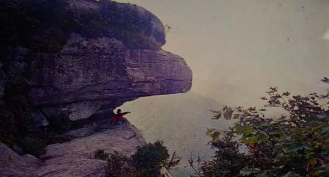
Photo
The great peak named Caesar's Head dominates the landscape in the northwest corner of Greenville County. Located along the border between North and South Carolina, the mountain was revered by the...